


What is Drone Mapping

 Story by:
Jimmy Bell
Story by:
Jimmy Bell
Drone mapping uses unmanned aerial vehicles (UAVs) to map a location. Research has shown that it is 90% quicker than ground-based mapping, and it can provide very high resolution detail at a much lower cost than other methods. Here we will briefly look at drone mapping and how it can be applied in the real world.
Drone Mapping – the Practicalities
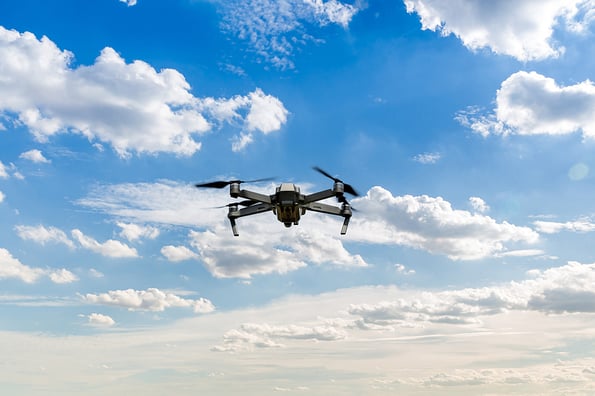
Simply, a UAV is flown over a location and uses high resolution photography to capture high resolution detail of the site. Different systems can be used, though most commonly photogrammetry and LiDAR can get exact measurements and detail of the location.
LiDAR has been around for many years and uses light in the same way as radio waves are in RADAR, timing the speed of photons reflected from a point instead of radio waves to achieve an accurate image. The hardware is still very expensive compared to photogrammetry that requires much simpler and cheaper equipment.
Photogrammetry involves taking thousands of 2D images with a high resolution camera – not unlike that used in a DSLR camera. The images are then ‘stitched together’ using Simultaneous Localization and Mapping (SLAM) software to achieve a highly accurate, measurable image of the site. Thanks to cost advantages, photogrammetry is much more competitive than LiDAR in most applications.
A Look at SLAM
Simultaneous Localization and Mapping (SLAM) such as that provided by dioram triangulates set points of a 3D location by monitoring those points over successive camera frames. In doing so the computer system can measure exact distances between points in the images. It can measure the height of a tree and all the trees around it, as well as the density of foliage on them for example to assess a forest’s health for example.
Drone Mapping Applications
Drone mapping using photogrammetry can be used in a wide range of applications. In this section we will take a brief look at four common examples.
- Land surveys – Data can be generated for real estate and other applications. For instance, flood risk can be assessed on a potential development and help decisions being made on how to mitigate such risk
- Agriculture and Forestry – Drone mapping can be used to look at the health of both the soil and vegetation on it. This can help efficient use of resources to maximize the potential of the land
- Mining and aggregates – In these applications the volume of ores or aggregates can be accurately assessed both before and during extraction
- Emergency Management and Investigation – drones can accurately map and measure the scene of an accident or situation and help leadership both assess the situation on the ground and investigate the events leading to it
Other applications include construction, real estate and even insurance & claims adjustment. As such the use of UAVs as a surveying tool has found a wide array of applications that are used in the modern day. With software technology such as SLAM making expensive hardware less necessary, it is becoming increasingly economical to use too, and this is leading to growing demand in turn.
Image Source: BigStockPhoto.com (Licensed)
Site Disclaimer
The Content in this post and on this site is for informational and entertainment purposes only. You should not construe any such information or other material as legal, tax, investment, financial, or other advice. Nothing contained on our Site constitutes a solicitation, recommendation, endorsement, or offer by HII or any third party service provider to buy or sell any securities or other financial instruments.
Nothing in this post or on this site constitutes professional and/or financial advice. You alone assume the sole responsibility of evaluating the merits and risks associated with the use of any information or other content in this post or on this site.
You recognize that when making investments, an investor may get back less than the amount invested. Information on past performance, where given, is not necessarily a guide to future performance.


Share options
Share this content with others